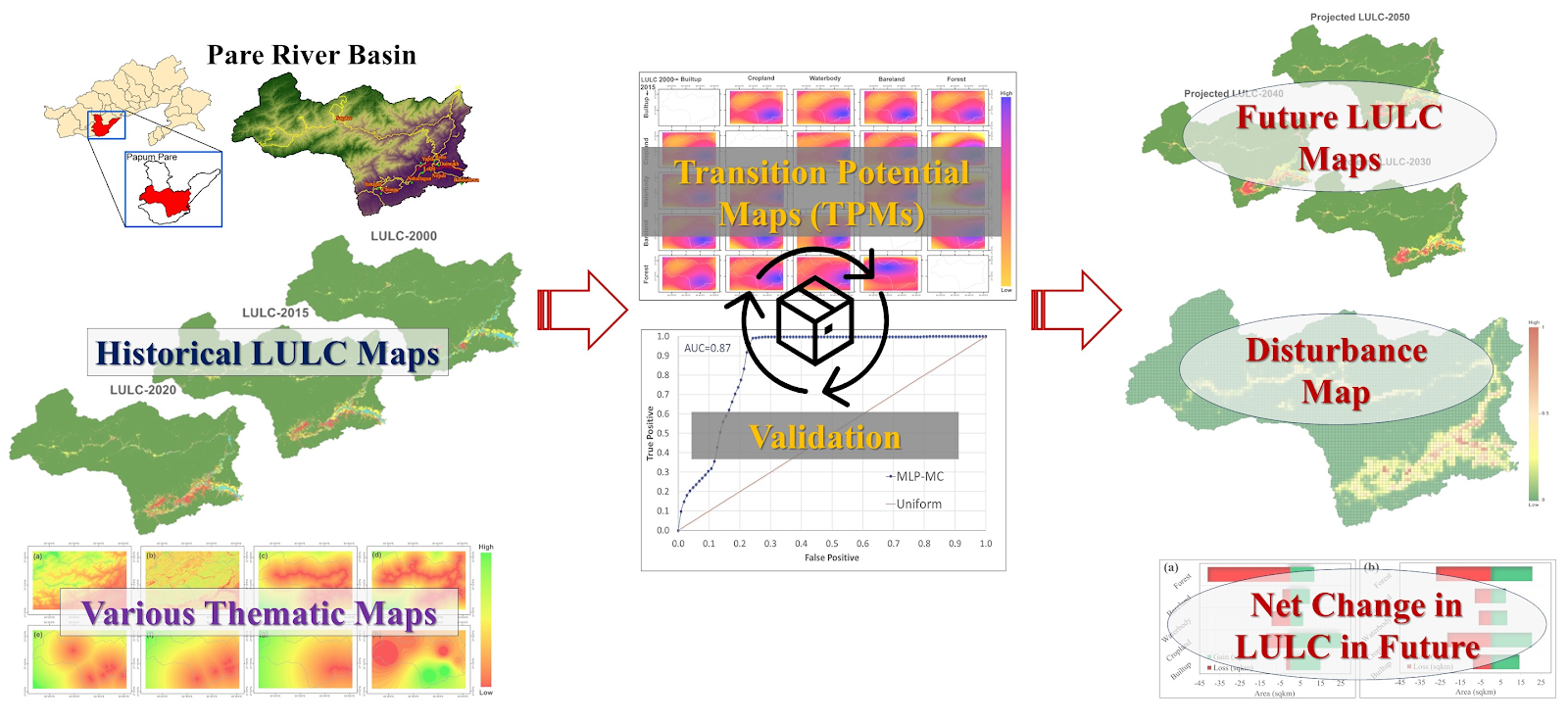
Scientist of North Eastern Regional Institute of Science and Technology (NERIST), have setup a model to investigate the impact of land use/land cover (LULC) changes in one of the basins of North East India. The model is based on a machine learning approach, specifically it is known as Markov Chain- Cellular automata (MC-CA). The study was conducted in Pare River Basin, located in the Papum Pare district of Arunachal Pradesh. This basin is home to a significant portion of the population of Arunachal Pradesh, as major cities, and towns, including the state capital Itanagar located in this region.
LULC changes are directly linked to the rate of development and population growth. Unplanned development and the encroachment of natural resources leads to changes in the environmental condition of the region, such as raising temperature, decrease in air quality and an uneven pattern of rainfall. The Pare River Basin is currently undergoing substantial developmental activities, including the construction of roads, buildings, cutting of hills, encroaching on waterbodies and deforestation. These changes have adverse effects on are biodiversity of the basin.
NERIST conducted this study to assess the potential impact of future LULC changes in the Pare River Basin. Three distinct LULC layers such as 2000, 2015 and 2020 were utilized to calibrate and validate the model. These layers were derived from Landsat 5 ETM and Landsat 8 OLI datasets using a machine learning algorithm, specifically Support Vector Machine (SVM), within the Google Earth Engine (GEE) environment. GEE, a web-based platform, facilities remote sensing and GIS operations in cloud. It offers the various datasets used in the cloud itself and performs different operations seamlessly. The model was set up using the TerrSet software which is developed by IDRISI. This model is calibrated by considering numerus factors influencing LULC changes in the region, such as elevation profile of the basin, slope, proximity to streams, roads, cities, waterbodies, railways and the total pollution level of the region. These factors were identified as significant contributors to LULC pattern changes in the region. While calibrating the model, multilayer perceptron (MLP) algorithms were employed. MLP is a feed forward neural network with input, output, and hidden layers, was trained to address non-linear problems.
The historical LULC layers (2000, 2015 and 2020) reveal an increase in built-up, bare land and agriculture land. On the other hand, a reduction in waterbodies and forest cover was observed. The rate of change is more pronounced for the forest area, with a rate of reduction of 2.79% from 2000 to 2020, followed by an increase in built-up area at a rate of 1.44% over the same period. With this finding It can be stated that the built-up areas are expanding at an expense of forest area and waterbodies. These findings are validated by spatial maps of the LULCs. After validation of this model using historical LULC layers, the model was employed to predict the LULC for future scenarios, specifically for the years 2030, 2040 and 2050. The pattern of change in LULC classes remains consistent in the future, indicating an increasing trend in built-up and cropland area, while the forest area continues to reduce at a higher rate. The rate of change is more significant in lowland areas with lower elevation, already residence of major settlements and are anticipated to see further growth in the future. Notably, forest degradation is more pronounced in the periphery of the forest area in the lowland regions. By observing these changes in LULC pattern a disturbance map was also generated, that can work as a guide to most focal areas in the basin for any management implementation. The disturbance map was scaled to 0 to 1, where 1 showing the most disturbed area and vice versa. These findings can be valuable for policymakers in developing a management plan for the basin, aiding in the identification of areas with the greatest disturbance. The disturbance map serves as a practical guide for implementing targeted interventions in focal areas within the basin.