url to published work: https://doi.org/10.2166/wcc.2023.406
With the country’s economy directly dependent on food grain production, accurate estimation of the net irrigation requirement (NIR) of crops is essential for maximizing production. In the recent past, there has been an increase in the percentage of groundwater utilized for irrigation in India. According to the Central Ground Water Board (CGWB 2020), over 60% of the total area irrigated in the country is being met by groundwater resources. The increasing dependency on groundwater as a source of irrigation water without proper recharging capacities of groundwater leads to the depletion of groundwater and lowers the water table. This creates an urgent need for the management of groundwater resources. Therefore, any strategy involved in the management of groundwater resources should consider both the supply and demand side at the regional scale. With changing climatic conditions and a growing population, future water availability is expected to further decline, raising demands for higher crop productivity. Further, the most common approach to study hydrological response to the change in climate is to run hydrological models using projected climatic variables (precipitation and temperature) from global climate models under different climate scenarios, downscaled or bias-corrected to the considered study area.
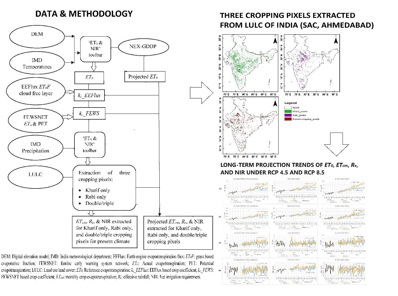
In this study, an attempt was made to estimate NIR for three different cropping pixels, i.e., Kharif-only, Rabi-only, and double/triple using satellite-derived monthly kc layers for the present climate. Due to the vast study area, collection of information on the specific type of crop grown and characteristics such as development stages, growth, water availability, etc., of each cropping area is impossible. Therefore, we estimated NIR using a satellite-derived kc layer for three cropping pixels, namely, Kharif-only, Rabi-only, and double/triple-cropping pixels over India. Two satellite-based crop coefficient layers were prepared for the study: (i) kc_EEFlux, the evaporative fraction layer from earth engine evapotranspiration flux (EEFlux) and (ii) kc_FEWS, the ratio of the famine early warning system network (FEWSNET) monthly actual evapotranspiration (ET) (ETa) to ET0_FEWSNET layers. The NIR was estimated for three different cropping pixels derived from the land-use land cover (LULC) map of India, namely, Kharif-only, Rabi-only, and double/triple pixels using ‘ET0 and NIR toolbar’. NASA’s Earth Exchange Global Daily Downscaled Projections (NEX-GDDP) dataset was employed for projecting the future scenario. Four models, namely, CCSM, CNRM, MPI, and MRI were selected from the NEX-GDDP dataset, which includes downscaled daily projections for RCPs 4.5 and 8.5 to evaluate the future scenario. Results suggested that FEWSNET offered more reliable estimates of NIR over EEFlux. To estimate the total volume of the irrigation water demand seasonally and annually, a summation of the NIR obtained from ‘ET0 and NIR toolbar’ multiplied with the area covered by each pixel was carried out for each of the three cropping pixels employed in the study. The seasonal NIRs for the Kharif-only, Rabi-only, and double/triple-cropping pixels were estimated to be 60,740.67, 49,936.44, and 1,48,709.58 Mm3 considering a 100% irrigated area. This indicated that an average of 259.39 BCM (billion cubic metres) of water is required for irrigating Kharif-only, Rabi-only, and double/triple-cropping pixels altogether each year. The projected ensemble NIR indicated a probable negative relative change during the Kharif season (RCP4.5: from -14.47 to -7.25%; RCP8.5: from -11.45 to -5.59%) while a probable positive relative change during the Rabi season (RCP4.5: 3.30–5.21%; RCP8.5: 2.34–8.83%).